
Sacramento
Relocation Guide

Moving to Sacramento: How to Choose the Right Neighborhood

Choosing a neighborhood in Sacramento involves balancing the historic walkability of the central grid with the spacious, park-heavy suburbs of the outer districts. This editorial guide breaks down the city's most desirable areas to help you find a home that matches your professional and recreational needs.

← All Sacramento Neighborhoods

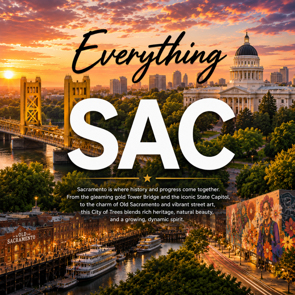
Sacramento has evolved far beyond its reputation as a quiet government town, emerging as a vibrant cultural destination at the confluence of the Sacramento and American Rivers. Known famously as the "City of Trees," the community boasts a thick urban canopy that defines the character of its historic residential streets. As California’s capital, the city offers a unique blend of architecture, from the ornate Victorians in the central grid to the iconic Mid-century estates of Land Park. Whether you are drawn to the bustling "Farm-to-Fork" dining scene in Midtown or the serene, river-adjacent paths of the Pocket-Greenhaven area, finding the right neighborhood requires understanding the distinct micro-cultures that exist within the city’s leafy borders. This guide provides an essential roadmap for navigating Sacramento's diverse housing landscape and lifestyle offerings.

The Central Grid: Midtown and Downtown

The heart of Sacramento’s social life is contained within the 'grid,' a series of numbered and lettered streets that comprise Downtown and Midtown. Midtown is the city’s cultural engine, known for its high walkability, historic Victorian-era homes, and the densest concentration of local boutiques and galleries. It is the site of the popular Second Saturday Art Walk and the Lavender Heights district, which serves as a hub for the LGBTQ+ community. Conversely, Downtown is the seat of government and commerce, anchored by the California State Capitol and the Golden 1 Center. While Downtown is more commercial, new residential developments like the Sawyer and various luxury lofts are increasing its 24-hour population. This area is ideal for those who prioritize proximity to the city’s most celebrated restaurants, such as Mulvaney’s B&L, and prefer a commute that can be accomplished entirely on foot or by bicycle.

Midtown Association / City of Sacramento Planning Division

Sacramento’s Distinct Neighborhood Districts

Sacramento is comprised of several distinct districts, each offering a different pace of life. East Sacramento is home to the famous 'Fab 40s,' a stretch of grand, stately homes known for elaborate holiday displays and film history. To the south lies Land Park, centered around William Land Park, which houses the Sacramento Zoo and Fairytale Town. Further south is the Pocket-Greenhaven area, a suburban peninsula formed by a loop in the Sacramento River, prized for its quiet cul-de-sacs and extensive canal bike paths. To the north, Natomas offers modern suburban living with quick access to the Sacramento International Airport and newer shopping centers. Oak Park, one of the city's oldest suburbs, has seen significant revitalization along the Broadway corridor, attracting new businesses and residents while maintaining its deep-rooted community identity. Tahoe Park remains a favorite for first-time homebuyers, characterized by its post-WWII cottages and active neighborhood association.

Sacramento City Council District Map / Sacramento Bee Real Estate Archives

Historic Character and Diverse Architecture

Sacramento’s housing stock is a visual timeline of California history. In neighborhoods like Boulevard Park and the Mansion Flats, you will find exceptionally preserved Italianate and Queen Anne Victorians dating back to the late 19th century. Moving toward East Sacramento and Land Park, the aesthetic shifts toward Tudor Revival, Mediterranean, and Colonial styles common in the 1920s and 30s. The city also holds a significant collection of Mid-century modern homes, particularly in the Streng and Eichler-inspired developments found in parts of South Land Park. This architectural diversity allows residents to choose between the high ceilings and ornate woodwork of historic properties or the open-plan, indoor-outdoor living popularized in the 1950s. While prices vary, the city remains generally more accessible than the San Francisco Bay Area, though the premium for well-maintained historic homes in the central core remains high.

Sacramento Heritage, Inc. / U.S. Census Bureau Data

Dining, Culture, and the Farm-to-Fork Identity

Sacramento officially branded itself as the 'Farm-to-Fork Capital' in 2012, reflecting its location in the heart of the Central Valley’s agricultural abundance. This identity is most visible in the neighborhood dining scenes. Midtown and East Sacramento are culinary hotspots where chefs have direct access to year-round produce. Iconic spots like The Kitchen (a Michelin-starred venue) and Tower Cafe define the local palate. Cultural landmarks are scattered throughout these neighborhoods, including the Crocker Art Museum—the oldest public art museum in the West—located on the edge of Downtown. For local entertainment, the historic Crest Theatre and the B Street Theatre at the Sofia provide intimate venues for film and performing arts. The neighborhood experience is further enriched by weekly farmers' markets, the largest of which is held under the freeway at 8th and W Streets, drawing thousands of residents every Sunday.

Visit Sacramento / California Department of Food and Agriculture

Outdoors and River Access

Outdoor life in Sacramento is dominated by the American River Parkway, a 32-mile 'green emerald' that stretches from Old Sacramento to Folsom Lake. Residents in neighborhoods like River Park and the American River Canyon have direct access to the Jedediah Smith Memorial Trail, a world-class paved path for cyclists, runners, and walkers. The parkway offers numerous points for kayaking, rafting, and fishing, making it a central pillar of the city's recreational life. Inside the city, William Land Park and McKinley Park serve as the primary urban lungs. McKinley Park is famous for its rose garden and public pool, while Land Park offers a golf course and sprawling picnic meadows. The confluence of the two rivers provides a unique waterfront experience, though much of the riverfront in the central city is dedicated to historic Old Sacramento and the Sacramento River Bike Trail.

Sacramento County Regional Parks / American River Parkway Foundation

Transit and Getting Around

Navigating Sacramento is facilitated by a logical grid system in the central city, but the wider metropolitan area relies heavily on a network of major freeways, including Interstate 5, Highway 99, and Business 80 (the Capital City Freeway). For those looking to avoid a car-centric lifestyle, the Sacramento Regional Transit (SacRT) operates a light rail system with three main lines—Blue, Gold, and Green—connecting the suburbs of Folsom, Citrus Heights, and Elk Grove to the downtown core. The city is also remarkably flat, which has fostered a robust cycling culture; many residents commute via the dedicated bike lanes that crisscross the grid. For regional travel, the Sacramento Valley Station serves as a major hub for Amtrak’s Capitol Corridor, providing easy rail access to the Bay Area. Understanding the traffic patterns at the 'fix-it' (the interchange of US-50 and I-80) is a prerequisite for any newcomer planning a suburban commute.

Sacramento Regional Transit / Caltrans District 3

Pros

  • • Dense urban tree canopy providing significant shade during summer months.
  • • Proximity to world-class recreation in Lake Tahoe and Napa Valley.
  • • Vibrant, award-winning culinary scene with emphasis on local sourcing.
  • • Diverse architectural styles ranging from 19th-century Victorians to modern builds.

Cons

  • • Summer temperatures frequently exceed 100 degrees Fahrenheit.
  • • Rising cost of living and housing compared to historical averages.
  • • Limited late-night public transportation options outside the central core.

Frequently Asked Questions

Which Sacramento neighborhood is the most walkable?

Midtown is widely considered the most walkable neighborhood in Sacramento. Its grid layout, high density of grocery stores, and concentration of bars and restaurants allow many residents to live without a car.

Is Sacramento a good place for families?

Yes, neighborhoods like Land Park, East Sacramento, and the Pocket are highly sought after by families for their excellent schools, safety, and abundance of public parks and playgrounds. William Land Park, in particular, is a major draw for children due to the zoo and theme parks located within it.

What is the commute like in Sacramento?

Commutes within the city grid are generally short, but traffic can become heavy on major arteries like Highway 50 and I-80 during peak hours. The light rail system offers a viable alternative for those commuting from the eastern or southern suburbs into Downtown.

Editor ReviewedLast updated: July 2, 2026By Everything Sacramento Editorial Team
Sources: City of Sacramento Official Website · Sacramento Regional Transit (SacRT) · Sacramento Bee · Visit Sacramento · U.S. Census Bureau (QuickFacts)